
THE WEBSITE
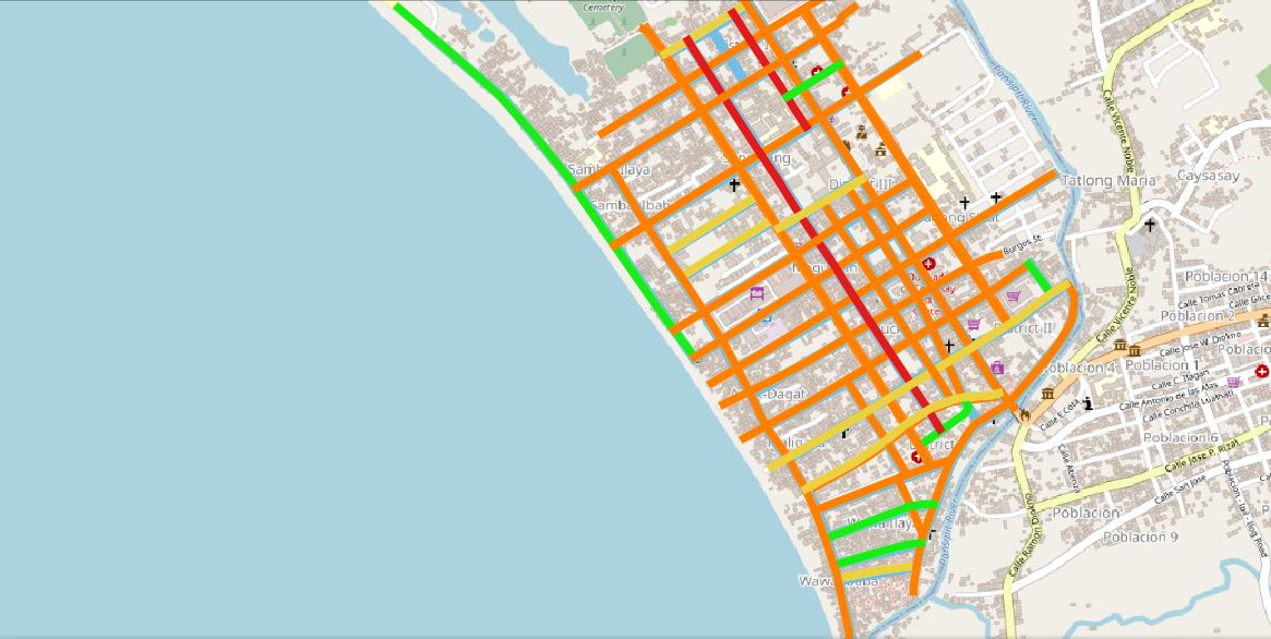
The Road and Traffic Index is a Geographic Information System (GIS) - embedded website that contains information about the road and traffic of Lemery, Batangas. The layers included in this website are as follows:
1. Pavement Distress
2. Vehicle Count
3. Surface Type
4. Surface Condition
5. Rehabilitated Pavement
6. Carriageway width
7. Road Classification
This website uses Quantum GIS (QGIS) in its application. It is an open-source license of GIS that provides aid in storing, visualizing, analyzing, and interpreting geographic data.
THE TEAM
This website is developed with the BS Civil Engineering students of Batangas State University, as part of the partial fulfillment of their CE Design Project.
The group, with members Hannah Beatriz Jardin, Alinna Maree Nibay, Shayne Rose Ortega, and Angelica Reyes, with Dr. Cristina Amor Rosales as their thesis adviser.